
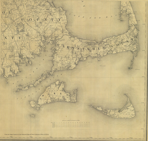
This reproduction shows the status of high-accuracy surveying in this area by the U.S. Coast and Geodetic Survey. It encompasses Martha's Vineyard, Nantucket, and a portion of Cape Cod. It shows the triangulation lines from survey points between the islands and the mainland. The ca 1880 surveying was to improve on the earlier high-accuracy surveying by work by Simeon Borden (1844). This map is excerpted from "Sketch A Showing the Progress of the Survey in Section No. 1 from 1844 to 1881". Original size 11" x 14". Reprinted in various sizes. Printed on high quality bond paper.

Cape Cod - Surveying Cape Cod and The Islands 1881 Custom Map Reprint U.S.C and G.S. Triangulation Lines
Was:
$147.90
Now:
$73.95
(No reviews yet)
Write a Review

Write a Review
Cape Cod - Surveying Cape Cod and The Islands 1881 Custom Map Reprint U.S.C and G.S. Triangulation Lines
- SKU:
- NT283388
- Condition:
- New
- Availability:
- Free Shipping from the USA. Estimated 2-4 days delivery.

1931 Map of |Cape Cod : Barnstable County Massachusetts|Cape Cod|Title: Cape Cod : Barnstable County
Was:
$129.88
Now:
$64.94

Loaded Lids Customized Womens Cape Cod Hat Cape Cod Baseball Cap Cape Cod
Was:
$129.06
Now:
$64.53

Cape Cod Photo Frame (Acrylic - Cape Cod Map, Lighthouse, Seagull)
Was:
$73.88
Now:
$36.94
Cape Cod & Islands Historical Map 1844 (18"x18")
Was:
$153.68
Now:
$76.84
