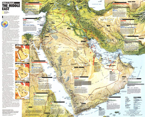
In August 1990 the Middle East's cauldron once again boiled over when Iraq invaded Kuwait, its wealthy and much smaller neighbor. Iraq claimed to be asserting due sovereignty from days of the Ottoman Empire, but the real motives seemed otherwise. Published in February 1991 during the Gulf War, this map accompanied the educational map The Middle East: States in Turmoil.
This detailed map features National Geographic's iconic cartographic style and typography. A variety of geographic features, including historic ruins, oil fields, and extensive transportation methods help tell the story of a region in the midst of conflict. As railways and roads snake through the sparsely populated interior of Saudi Arabia and Iran, contrasted heavily with the density of Turkey, the borders of Saudia Arabia, Yemen, Oman and the United Arab Emirates remain unclear.
This map is drawn in the Albers Conic Equal-Area projection, which uses two standard parallels between which distortion is minimized, however scale and shape is not preserved.
A truly vibrant and unique conversation piece, this map makes a fine companion to The Middle East: States in Turmoil, with which it was published.
Your laminated map has a glossy finish so that you can use dry erase markers on the map to highlight features, make plans, and share unique information with others. Lamination is also extremely durable, resistant to folding or ripping.
Your map is rolled and packaged in a sturdy tube to protect it during shipment.


