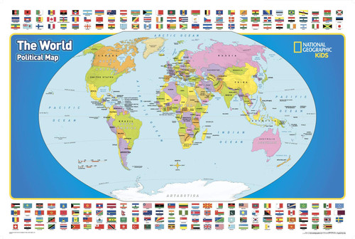
National Geographic's educational world map for kids between grades 4 and 12 represents the best of national geographic products - rich in information and learning and pleasing to the eye. This product does a great job of teaching students about the countries of the world, and where they are located, with a handy index beneath the map. Using latitude and longitude as the index locations, students intuitively learn important map reading skills while learning about our planet - important skills that are often neglected into today's digital GPS driven world.
This is all captured in this large map that makes the world's 195 countries easy to identify along with the oceans, continents and major cities. Designed specifically for elementary school-age children, an appropriate level of detail is included for this age group that goes beyond what young children can absorb, yet does not overwhelm.
National Geographic's graded-series of maps are the first to address the unique needs of K-12 students as they advance their understanding of our World. Unlike other classroom poster maps, this world map uses the Winkel-Triple projection, which provides the best combination of size, shape, and distance giving the student the best visual representation of the Earth's surface in two dimensions. This solves the misleading effect seen on other maps where Greenland appears larger than South America.
National Geographic's maps are the standard by which all other reference maps are measured. The maps are meticulously researched and adhere to National Geographic's convention of making independent, apolitical decisions based on extensive research using multiple authoritative sources.
Printed on high quality thick paper strong enough for display on your wall.
Your map is rolled and packaged in a sturdy tube to protect it during shipment.


