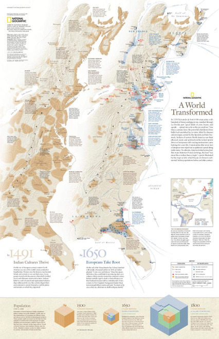
Without John Rolfe, Jamestown, Virginia would never have succeeded. Without the European honeybee, Georgia would never have become the Peach state, and Johnny Appleseed's trees may never have borne fruit. This unique map chronicles the history of the eastern North American seaboard since Hernando de Soto's 600-man army landed in present-day Florida - transforming the land and the people on it forever.
Up to 1491, Ingidenous cultures thrived. Eastern North America was a fertile breadbasket, and a web of natural and supernatural forces shaped the people who nurtured and cultivated the earth. By 1650, European settlers had firmly taken root, and, through treaties and alliances, began spreading their cultures throughout the land, slowly erasing those of the Indigenous populations.
Explore how the eastern seaboard changed over the centuries - from boundaries to the explosion of population thanks to European colonization. Consider how the Indigenous population fell from over 1 million on the eve of colonization to the 1800s, when even African slaves outnumbered them by nearly 10:1.
This map is ideal for the classroom or for anyone who wishes to gain insight into the forces of colonialism and the history that made North America what it is today. A perfect companion to North American Indian Cultures.
Printed on high quality thick paper strong enough for display on your wall.
Your map is rolled and packaged in a sturdy tube to protect it during shipment.


