Map of the coast from Hampton, Virginia, to Old Cedar Inlet, North Carolina, showing roads, railroads, rivers and streams, and place names. Soundings are not given.
Historic Prints 16" x 24" 1862 Map of Coast of North Carolina & Virginia
MSRP:
Was:
$127.60
Now:
$63.80
(You save
)
(No reviews yet)
Write a Review
Write a Review
![Historic Prints 16" x 24" 1862 Map of Coast of North Carolina & Virginia Historic Prints 16" x 24" 1862 Map of Coast of North Carolina & Virginia](https://cdn11.bigcommerce.com/s-t8bvbs505h/images/stencil/500x659/products/29700627/31412156/8130Js8FwqL__75963.1709598954.jpg?c=2)
Historic Prints 16" x 24" 1862 Map of Coast of North Carolina & Virginia
- SKU:
- ZY537925
- UPC:
- 766894469865
- Condition:
- New
- Availability:
- Free Shipping from the USA. Estimated 2-4 days delivery.
![1862 map Preliminary Chart of The Atlantic Coast : from The Entrance of Chesapeake Bay to Ocracoke Inlet|Size 16x24 - Ready to Frame| Atlantic Coast NC|Atlantic Coast|Coasts|North Carolina|Virginia 1862 map Preliminary Chart of The Atlantic Coast : from The Entrance of Chesapeake Bay to Ocracoke Inlet|Size 16x24 - Ready to Frame| Atlantic Coast NC|Atlantic Coast|Coasts|North Carolina|Virginia](https://cdn11.bigcommerce.com/s-t8bvbs505h/images/stencil/500x659/products/28527098/30179141/61EJ7sddNKL__62266.1703809026.jpg?c=2)
Add to Cart
The item has been added
![Historic Prints 16" x 24" 1862 Map of United States of Kentucky Railroad Network Historic Prints 16" x 24" 1862 Map of United States of Kentucky Railroad Network](https://cdn11.bigcommerce.com/s-t8bvbs505h/images/stencil/500x659/products/28697909/30357547/91W7TIJXZfL__37154.1703986449.jpg?c=2)
Add to Cart
The item has been added
Historic Prints 16" x 24" 1862 Map of United States of Kentucky Railroad Network
MSRP:
Was:
$127.60
Now:
$63.80
![Historic Prints 16" x 24" Map of Mount Desert Island & The Coast of Maine Historic Prints 16" x 24" Map of Mount Desert Island & The Coast of Maine](https://cdn11.bigcommerce.com/s-t8bvbs505h/images/stencil/500x659/products/29700626/31412155/61reVVYwb1L__54925.1709598954.jpg?c=2)
Add to Cart
The item has been added
Historic Prints 16" x 24" Map of Mount Desert Island & The Coast of Maine
MSRP:
Was:
$127.60
Now:
$63.80
![Historic Prints 16" x 24" 1863 Map of Greensville County West of Halifax Road & North Carolina Between The Halifax & Jourdan RDS & North of The Roanoke River Historic Prints 16" x 24" 1863 Map of Greensville County West of Halifax Road & North Carolina Between The Halifax & Jourdan RDS & North of The Roanoke River](https://cdn11.bigcommerce.com/s-t8bvbs505h/images/stencil/500x659/products/28697898/30357536/41sr8swWcXL__96593.1703986444.jpg?c=2)
Add to Cart
The item has been added
![Historic Prints 20" x 24" 1862 Map of Original District of Columbia Washington Historic Prints 20" x 24" 1862 Map of Original District of Columbia Washington](https://cdn11.bigcommerce.com/s-t8bvbs505h/images/stencil/500x659/products/28697919/30357557/81Znezlf_HL__84341.1703986454.jpg?c=2)
Add to Cart
The item has been added
Historic Prints 20" x 24" 1862 Map of Original District of Columbia Washington
MSRP:
Was:
$127.60
Now:
$63.80
![Historic Prints 18" x 24" 1624 Map Virginia Historic Prints 18" x 24" 1624 Map Virginia](https://cdn11.bigcommerce.com/s-t8bvbs505h/images/stencil/500x659/products/29700660/31412189/71TxIbKKpeL__67057.1709598970.jpg?c=2)
Add to Cart
The item has been added
Historic Prints 18" x 24" 1624 Map Virginia
MSRP:
Was:
$127.60
Now:
$63.80
![Historic Prints 20" x 24" 1624 Map Virginia Historic Prints 20" x 24" 1624 Map Virginia](https://cdn11.bigcommerce.com/s-t8bvbs505h/images/stencil/500x659/products/29700659/31412188/61u765FTgpL__38265.1709598970.jpg?c=2)
Add to Cart
The item has been added
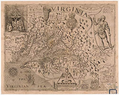
Historic Prints 20" x 24" 1624 Map Virginia
MSRP:
Was:
$127.60
Now:
$63.80
![1860 map County map of Virginia, and North Carolina|Size 20x24 - Ready to Frame| Civil War|History|North Carolina|Virginia 1860 map County map of Virginia, and North Carolina|Size 20x24 - Ready to Frame| Civil War|History|North Carolina|Virginia](https://cdn11.bigcommerce.com/s-t8bvbs505h/images/stencil/500x659/products/28527097/30179140/818x50GZmQL__77162.1703809026.jpg?c=2)
Add to Cart
The item has been added
1860 map County map of Virginia, and North Carolina|Size 20x24 - Ready to Frame| Civil War|History|North Carolina|Virginia
MSRP:
Was:
$109.90
Now:
$54.95
![Historic Prints 20" x 24" 1863 Map of Fluvanna County Virginia Historic Prints 20" x 24" 1863 Map of Fluvanna County Virginia](https://cdn11.bigcommerce.com/s-t8bvbs505h/images/stencil/500x659/products/28697897/30357535/51aPaHFqfxL__42694.1703986444.jpg?c=2)
Add to Cart
The item has been added
Historic Prints 20" x 24" 1863 Map of Fluvanna County Virginia
MSRP:
Was:
$127.60
Now:
$63.80
!