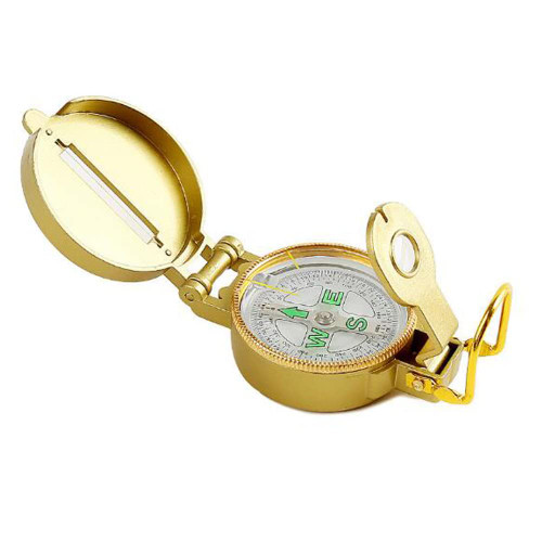
Product functions
North pointing, orientation, positioning, distance measurement, slope measurement (pitch angle), azimuth measurement, mapping ruler, magnifying glass, etc..
Product features
Carry ring: can be bolted lanyard, in the need for frequent use and the two hands are occupied, can be hung around the neck or with the hand to get the place.
Product use instructions
1. damping dial is conducive to the stability of the pointer, more suitable for sports, rugged environment, the arrow indicates the N pole (North Pole), which is also the vast majority of the north compass labeling method
2. A rotatable azimuth plate, which can be rotated and positioned by a leaf-shaped spring and the toothed edge of the plate.
There is a magnifying glass on the dial plate to see the bearing more clearly, do not underestimate the long and short lines, many functions are achieved through it
The scale of the inner circle of the damping dial is 360 degrees azimuth angle division, the scale of the outer circle is 64-00 dense system division, dense division is a common unit of azimuth measurement in the military, the United States and the original NATO standard is 64-00 system, China and the original Warsaw Pact standard is 60-00 system, according to the different dense system corresponding 1 dense converted to angle = 360 / dense system (degrees), American 64-00 The close-point system compass 1 close-point = 360/6400 = 0.05625 (degrees), China's type 97 compass using the 60-00 close-point system, 1 close-point = 360/6000 = 0.06 (degrees).
3. Determine the north, the correct way is this, in the palm of the hand end flat, the arrow (N pole) pointed to is the north.
4. It is simple to correct the orientation of the map, but it is the basis of all map work: put the map flat, and then correct the map orientation by aligning the map's north marker with the N


