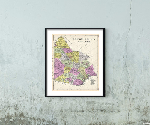
A highly appealing 1912 large format folio map of Orange County, New York, issued for the New Century Atlas of Counties of the State of New York . The map covers the west side of the Hudson River from Newburg to Highland, including New Windson, Cornwall, Woodbury, Tuin, xedo, Monroe, Warwick, Chester, Blooming Grove, Hamptonburg, Goshen, Wawayanda, Minisink, Greenville, Deerpark, Mount Hope, Wallkill, Montgomery and Crawford. There is appealing detail throughout with the roads, towns, and railroad lines clearly represented. Various communities are identified with larger districts highlighted in, vivid pastels. This map was issued as plate nos. 168 and 169 in, Everts' New Century Atlas of Counties of the State of New York .
1912 Century of Orange County, New York Map|Vintage Fine Art Reproduction|Size: 20x24|Ready to Frame
MSRP:
Was:
$129.88
Now:
$64.94
(You save
)
(No reviews yet)
Write a Review

Write a Review

1912 Century of Orange County, New York Map|Vintage Fine Art Reproduction|Size: 20x24|Ready to Frame
- SKU:
- ZDW826061
- UPC:
- 722802059139
- Condition:
- New
- Availability:
- Free Shipping from the USA. Estimated 2-4 days delivery.

Add to Cart
The item has been added
1877 Map of Pawling, N.Y. Map of Duchess County, New York |Vintage Fine Art Reproduction|Ready to Frame
MSRP:
Was:
$129.88
Now:
$64.94

Add to Cart
The item has been added
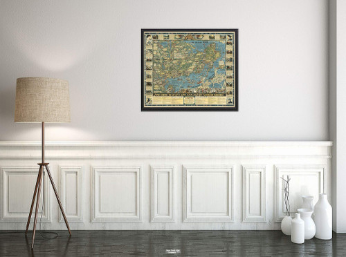
Map|A Romance of The Finger Lakes Region of Central New York, 1962|Vintage Fine Art Reproduction|Size: 20x24|Ready to Frame
MSRP:
Was:
$129.88
Now:
$64.94

Add to Cart
The item has been added

Add to Cart
The item has been added
Map|Wall, New Zealand - Physical 1951|Vintage Fine Art Reproduction|Size: 20x24|Ready to Frame
MSRP:
Was:
$129.88
Now:
$64.94

Add to Cart
The item has been added

Add to Cart
The item has been added

Add to Cart
The item has been added
1856 Kiepert of Lebanon Map|Vintage Fine Art Reproduction|Size: 20x24|Ready to Frame
MSRP:
Was:
$129.88
Now:
$64.94

Add to Cart
The item has been added
1922 Map|No. 32: Zacatecas|Vintage Fine Art Reproduction|Size: 20x24|Ready to Frame
MSRP:
Was:
$129.88
Now:
$64.94

Add to Cart
The item has been added
1890 Hachette of Antarctica Map|Vintage Fine Art Reproduction|Size: 20x24|Ready to Frame
MSRP:
Was:
$129.88
Now:
$64.94
!

