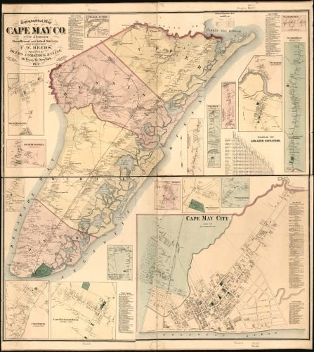
Summary: Notes: County cadastral map showing townships, warranty-deed land tracts, warranty numbers, real-property tracts, some landowners' names, park lands, rural buildings, and householders' names; borough insets show property tracts (lots), lot numbers, owners' names, and building coverage. Hand col. to emphasize township boundaries, townships territories, and park lands. "Entered according to Act of Congress in the Year 1872 by F.W. Beers & Co. in the Office of the Librarian of Congress at Washington D.C." imperfect: Annotated in lead pencil, brittle, missing small sections along inner edges, cloth hemmed. Includes inset "Map of the state of Pennsylvania", population statistical tables, distance table, local business directories, and 13 village/borough insets (including Milford and Matamoras). Land ownership map, 786 2 copies Created / Published: New York : F.W. Beers & Co., 1872
1872 Map Topographical map of Pike County, Pennsylvania : from recent and actual surveys and records
MSRP:
Was:
$129.88
Now:
$64.94
(You save
)
(No reviews yet)
Write a Review

Write a Review

1872 Map Topographical map of Pike County, Pennsylvania : from recent and actual surveys and records
- SKU:
- ZY555541
- UPC:
- 7108909296180
- Condition:
- New
- Availability:
- Free Shipping from the USA. Estimated 2-4 days delivery.

Add to Cart
The item has been added
Historic Prints HP 18" x 24" 1872 Topographical Map of Pike County Pennsylvania from Recent & Actual Surveys & Records
MSRP:
Was:
$127.60
Now:
$63.80

Add to Cart
The item has been added
1869 Map|Title: Topographical map of Wyoming Co., Pennsylvania : from recent and actual surveys and
MSRP:
Was:
$129.88
Now:
$64.94

Add to Cart
The item has been added
Historic Prints HP 20" x 24" 1872 Map of Topographical Map of Cape May County New Jersey from Recent & Actual Surveys
MSRP:
Was:
$127.60
Now:
$63.80

Add to Cart
The item has been added
1872 Map Topographical map of Cape May Co, New Jersey : from Recent and Actual surveys - Size: 20x2
MSRP:
Was:
$119.88
Now:
$59.94

Add to Cart
The item has been added
INFINITE PHOTOGRAPHS 1861 Map Topographical map of Centre Co Pennsylvania from Actual surveys - Size 20x24 - Ready t
MSRP:
Was:
$97.88
Now:
$48.94

1858 Map Scott's map of Lancaster County, State of Pennsylvania : from Actual Measurements - Size: 1
MSRP:
Was:
$95.66
Now:
$47.83

Add to Cart
The item has been added
1854 Map of Berks County, Pennsylvania : from surveys - Size: 18x24 - Ready to Frame - Berks County
MSRP:
Was:
$129.88
Now:
$64.94

1886 Map New map of Kings and Queens Counties, New York : from Actual surveys. - Size: 22x24 - Ready
MSRP:
Was:
$95.66
Now:
$47.83

Add to Cart
The item has been added
!

