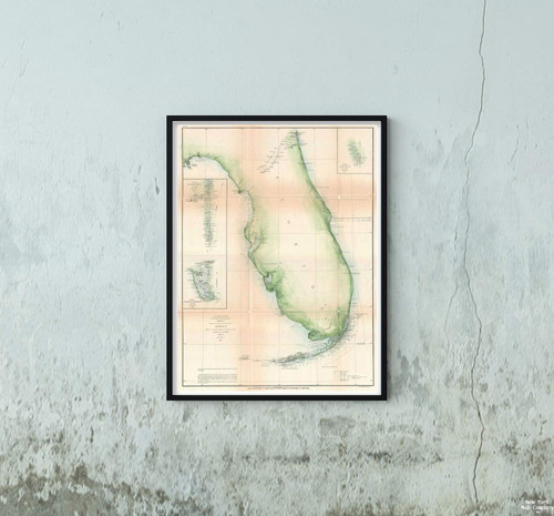
A very attractive example of the 1860 U.S. Coast Survey triangulation chart or map of southern Florida and the Florida Keys. Covers from Key Biscayne Bay south along the Keys, past Key West, as far as the Marquesas Keys. Countless triangulation points are noted throughout. Names each of the Keys and identifies Miami at the northern edge of Key Biscayne Bay, and the city of Key West, at the time a prosperous center of commerce. The chart was produced in, 1860 under the supervision of A. D. Bache, one of the most influential and prolific Superintendents of the U.S. Coast Survey.
1860 U. S. Coast Survey Chart Triangulation Antique The Florida Keys Map|Vintage Fine Art Reproduction|Size: 14x24|Ready to Frame
MSRP:
Was:
$129.88
Now:
$64.94
(You save
)
(No reviews yet)
Write a Review

Write a Review

1860 U. S. Coast Survey Chart Triangulation Antique The Florida Keys Map|Vintage Fine Art Reproduction|Size: 14x24|Ready to Frame
- SKU:
- ZY553286
- UPC:
- 709092065644
- Condition:
- New
- Availability:
- Free Shipping from the USA. Estimated 2-4 days delivery.

Add to Cart
The item has been added
1861 U. S. Coast Survey Chart or of Florida Map|Vintage Fine Art Reproduction|Size: 18x24|Ready to Frame
MSRP:
Was:
$114.98
Now:
$57.49

Add to Cart
The item has been added

Add to Cart
The item has been added
Map|Guayaquil. 1827|Vintage Fine Art Reproduction|Size: 14x24|Ready to Frame
MSRP:
Was:
$129.88
Now:
$64.94

Add to Cart
The item has been added
Map|1856 U.S. Coast Survey of Mobile Bay, Alabama -|Vintage Fine Art Reproduction|Size: 18x24|Ready to Frame
MSRP:
Was:
$129.88
Now:
$64.94

Add to Cart
The item has been added
1929 Map|World Atlas 81. Bulgaria|Vintage Fine Art Reproduction|Size: 14x24|Ready to Frame
MSRP:
Was:
$129.88
Now:
$64.94

Add to Cart
The item has been added
Map|Chicago Transit s, Chicago Surface Lines Transit/RR|Vintage Fine Art Reproduction|Size: 14x24|Ready to Frame
MSRP:
Was:
$129.88
Now:
$64.94

Add to Cart
The item has been added

Add to Cart
The item has been added
1892 Map|State Atlas Manchester, N.H. City, Town|Vintage Fine Art Reproduction|Size: 14x24|Ready to Frame
MSRP:
Was:
$129.88
Now:
$64.94
!


