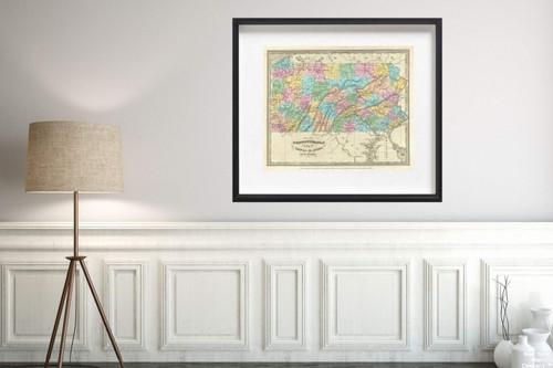
This is an important 1834 first edition map of Pennsylvania by David H. Burr. Depicts the state in, detail, noting rivers, roads, cities, town and other topographical features, with elevation rendered by hachure. Offers color-coding at a county level. It is very uncommon to find an early 19th century map exclusively depicting Pennsylvania, as most maps of the period bundled it with New Jersey. According to Ristow, although Burr is credited on the title page, he left this atlas incomplete. He was appointed as topographer to the U.S. Post Office, and of the siin, xty-three maps finally included in, this atlas, only completed eight. The rest of the maps were then completed by Illman and Pilbrow in, Burr's style. This map was ‘Entered according to act of Congress in, the year 1834 by Illman and Pilbrow in, the Clerk's office of the District Court for the Southern District of New York', but was not published until the atlas was released in, 1835. Published by D. S. Stone in, Burr's New Universal Atlas .
1834 Burr Antique of Pennsylvania Map|Historic Antique Vintage Reprint|Size: 20x24|Ready to Frame
MSRP:
Was:
$129.88
Now:
$64.94
(You save
)
(No reviews yet)
Write a Review

Write a Review

1834 Burr Antique of Pennsylvania Map|Historic Antique Vintage Reprint|Size: 20x24|Ready to Frame
- SKU:
- ZY555873
- UPC:
- 722802066762
- Condition:
- New
- Availability:
- Free Shipping from the USA. Estimated 2-4 days delivery.

Add to Cart
The item has been added

Add to Cart
The item has been added
1833 Map|Eagle of the United States|Historic Antique Vintage Reprint|Size: 20x24|Ready to Frame
MSRP:
Was:
$129.88
Now:
$64.94

Add to Cart
The item has been added
1775 Map|Regional Atlas St. Lucia|Historic Antique Vintage Reprint|Size: 20x24|Ready to Frame
MSRP:
Was:
$129.88
Now:
$64.94

Add to Cart
The item has been added
1884 Map|World Atlas Original Thirteen Colonies|Historic Antique Vintage Reprint|Size: 20x24|Ready to Frame
MSRP:
Was:
$129.88
Now:
$64.94

Add to Cart
The item has been added

Add to Cart
The item has been added
Map|World Atlas, Provincia di Calabria Ultra 1714|Historic Antique Vintage Reprint|Size: 20x24|Ready to Frame
MSRP:
Was:
$129.88
Now:
$64.94

Add to Cart
The item has been added

Add to Cart
The item has been added

Add to Cart
The item has been added
!

